
Totems & History
Creek Street's boardwalk brothels, 19th-century poles saved from abandoned villages, and the Tlingit village of Saxman a short ride south.

Tongass Historical Museum
The city museum on Ketchikan's story, from Tlingit fish camp to cannery town, steps from Creek Street.

Totem Heritage Center
A city museum holding weathered 19th-century totem poles brought in from abandoned Tlingit and Haida villages.

Saxman Totem Park
An outdoor park of carved poles in the Tlingit village of Saxman, a short ride south of downtown.

Totem Bight State Historical Park
A seaside state park with a replica clan house and poles carved in the CCC era, about 10 miles north of town.

Potlatch Totem Park
A privately owned park next to Totem Bight, with replica clan houses and a carving shed.
Walking map: the berths and downtown Ketchikan
The four city berths run along Front Street, numbered 1 to 4 from south to north. Creek Street, the Tongass Historical Museum and the salmon ladder are a short walk south and east, and the Totem Heritage Center is about 15 to 20 minutes on foot or a free summer shuttle ride.
Map: USGS elevation; streets and buildings © OpenStreetMap contributors.
Featured history articles
The best reading online about Ketchikan's past, from public radio, the city, tribal organizations and local historians. Each opens on the original site.

Ketchikan, Alaska
The Tlingit name for the town is Kichx̱áan, from an older name for Ketchikan Creek whose meaning is uncertain. Mike Martin, sent by an Oregon canning firm, started a saltery and store with George Clark in 1885. The town incorporated on August 25, 1900, and is the oldest incorporated city still existing in Alaska.
Read on en.wikipedia.org ↗City of Ketchikan: a history for preservation
The state's preservation office traces the town from a Tlingit fish camp at the creek mouth to its first saltery in 1883 and the canneries that followed. It covers the 1903 power company's spruce mill, which became Ketchikan Spruce Mills in 1923 and made lumber and salmon boxes for over 70 years. It also notes the 1909 Tongass National Forest boundaries and the Stedman-Thomas district's mix of Scandinavian, Japanese, Filipino and Native residents.
Read on dnr.alaska.gov ↗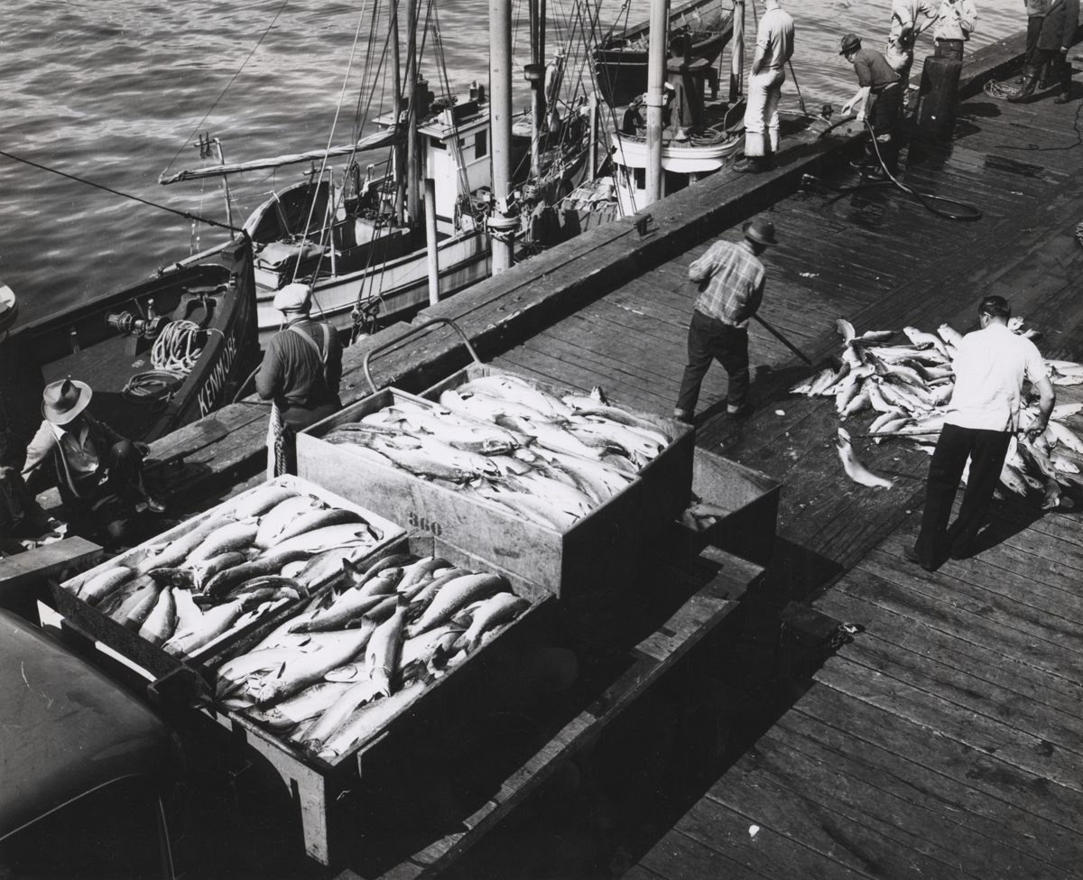
Ketchikan calls itself 'Salmon Capital of the World.' Does the title still fit?
In 1937 the 14 canneries around Ketchikan packed 850,000 cases of salmon. By 1971 not one can was packed in the city, and today three plants remain. The piece explains how fish traps emptied the runs and how banning them was among the new state's first acts after 1959. It also covers hatcheries and the salmon treaty with Canada. Photo: E.P. Haddon, NOAA Central Library Historical Fisheries Collection, c. 1950 (public domain).
Read on andthewest.stanford.edu ↗Creek Street (Ketchikan, Alaska)
A 1903 city ordinance pushed brothels out of the business district to the east bank of Ketchikan Creek. Houses went up on stilts over the steep ground, and the district ran until brothels were outlawed in 1954. Customers are said to have used a hillside path, the Married Man's Trail, to avoid police raids. The street became a National Register historic district in 2014.
Read on en.wikipedia.org ↗Dolly's House (24 Creek Street)
This architectural entry describes the one-and-a-half-story house where Dolly Arthur lived from 1919 to 1973, now a museum furnished mostly with her own belongings. It says Creek Street was the red-light district from 1902 to 1954, and that an ordinance limiting each house to two women kept the buildings small.
Read on sah-archipedia.org ↗Totem Bight State Historical Park: how the park began
Many poles were rotting in the woods after families left their villages for work in towns. In 1938 the Forest Service used Civilian Conservation Corps money to hire older Native carvers, who trained younger ones while repairing or copying the poles. By the time World War II slowed the work, a community house and 15 poles stood at the site. The state took it over in 1959.
Read on dnr.alaska.gov ↗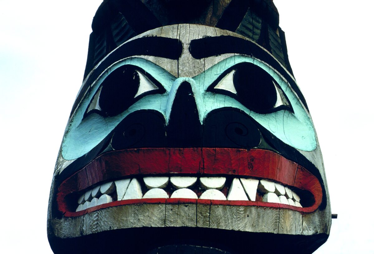
Saxman Totem Park: National Register nomination
The nomination explains how Saxman became the gathering place for carvings from deserted Tlingit towns and graveyards at Old Tongass, Cat Island, Village Island, Pennock Island and Cape Fox, whose people largely settled in Saxman. Much of the park was built under the CCC in the 1930s. The Lincoln pole arrived in 1938, and the Sun and Raven pole, first carved by Kahctan in 1902, was raised on April 11, 1939. Photo: Cmdr. George Leigh, NOAA Corps, 1976 (public domain).
Read on npgallery.nps.gov ↗Ketchikan museum catalogs historic totem pole fragments
This story follows curators cataloging hundreds of pole fragments in the museum basement. It recounts how the American Legion brought poles into town in 1929 and how a 1969-1971 retrieval project collected the last poles left standing at Old Kasaan (Haida) and Tongass and Village islands (Tlingit). alaska.org says the poles recovered in 1970 went to what is now the Totem Heritage Center.
Read on juneauempire.com ↗How developers plan to turn a symbol of Ketchikan's timber past to a hub for tourism
The Ward Cove pulp mill carried the local economy for more than 40 years, with about 500 direct jobs and as many again indirectly, until it shut in 1997. The town lost nearly a tenth of its population afterward. Sunken logs and waste fouled the cove floor until a sand cap over about 80 acres let sea life return. Developers then planned a cruise dock on the site.
Read on krbd.org ↗Gravina Island Bridge
A $398 million bridge was meant to replace the airport ferry to Gravina Island, home to the airport and about 50 people. Backed by Rep. Don Young and Sen. Ted Stevens, it became the national symbol of earmark spending as the 'Bridge to Nowhere'. Gov. Sarah Palin dropped it in 2007, though a highway built for it was finished and nicknamed the 'road to nowhere'. Improved ferry service was chosen instead in 2015.
Read on en.wikipedia.org ↗Ketchikan set to surpass Juneau in cruise passengers for the first time
Ketchikan was expected to edge out Juneau in cruise passengers in 2026, a first, after Juneau's daily limits pushed ships to other ports. The story describes the private Mill at Ward Cove, which opened in 2021 about eight miles north of town, as growing in phases with a second lumberjack show and new shops.
Read on juneauindependent.com ↗Totem Heritage Center: why the old poles came to town
A short background on the golden age of pole carving, from the mid-1700s to the late 1800s, when fur-trade wealth paid for potlatches and new iron tools. Epidemics of smallpox and tuberculosis then emptied villages. Some poles were moved in the 1930s, and the last standing ones were brought to Ketchikan in summer 1970 for safekeeping.
Read on alaska.org ↗Summaries are ours. Each article opens on the original site.
A printable Ketchikan plan for your hours ashore
Leave your email and you’ll go right to a day plan timed to your ship’s arrival and departure, ready to print with the map. We write once a month about berths, busy days and what’s open.